
WELCOME TO NEWBROUGH

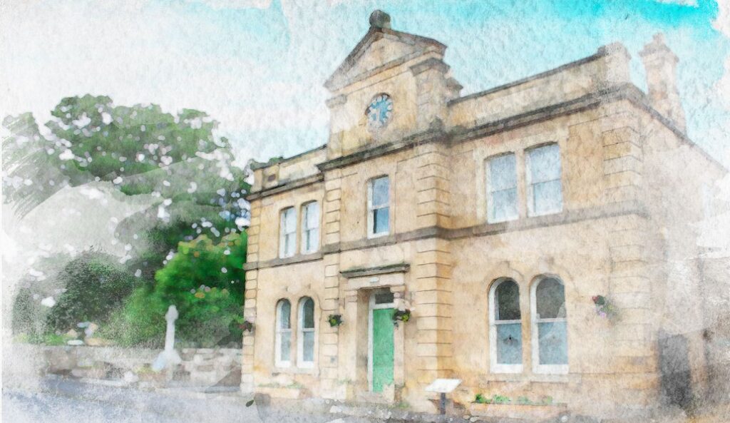
Newbrough boasts one of the finest Town Halls in Tynedale, built in 1876 and extensively modernised in 2000. Newbrough Church of England Primary School has pupils from age four to eleven. The Red Lion, an old coaching inn, dates back to the 1190s. The spiritual needs of residents are served by St. Peters C of E Church and the Fourstones and Warden Methodist Church.
Newbrough Parish stretches from the South Tyne to the Roman Wall and extends as far as Northumberland National Park to the west. Local residents and visitors enjoy walking, cycling and riding along the paths and bridleways that cross the attractive landscape of the parish.
Other smaller settlements within the parish include Settlingstones and Allerwash.
the parish
Newbrough was historically part of the Manor of Thornton which was granted weekly market by Henry III in 1221. Thornton Tower was reported to be in a state of decay in a survey in 1541; it is Grade II listed building.
Newbrough sits on the Stanegate Roman road, built in A.D. 71, which runs from east to west and formed the original Roman northern frontier before the building of Hadrian’s Wall. St Peter’s Church stands on the site of one of the line of forts along this road.
The parish has twenty eight Grade II Listed buildings many of which are situated in the Newbrough Conservation Area. Newbrough Hall, an early 19th-century country house is Grade II* Listed.
Newbrough is in the Green Belt and part of the parish lies within the Northumberland National Park. To the north the parish forms part of the Hadrian’s Wall World Heritage Site where some of our twelve scheduled Ancient Monuments are located.
THE PARISH COUNCIL
Newbrough Parish Council was first formed in 1894 by an Act of Parliament. Prior to that all local matters were dealt with by the Church; Ecclesiastical Parish of Warden and Newbrough. Initially there was a problem with the literacy of the local Parishes. The leaders in the Villages were typically the Squires (because of their wealth), and the Parson. Even though this act was passed it took 60 years for councils to emerge as an effective level of local Government.
Newbrough has seven Councillors of which the Chairman and Vice Chairman are elected annually. There has to be a quorum to pass resolutions, i.e. minimum of three or one third of the Council.
Councillors are elected for a 4 year term. If a vacancy occurs during this term, it can be filled by either an election or by co-option.
In Newbrough we usually hold Council Meetings on the first Wednesday of alternative months (January, March, May, July, September and November) The Annual Meeting of the Parish is held in May and follows the Annual meeting of the Parish.